Resilient Communities

  • DESIGN FOR RESILIENCE DESIGN FOR RESILIENCE DESIGN FOR RESILIENCE DESIGN FOR RESILIENCE

    DESIGN FOR RESILIENCE

    The impacts of climate change are already having a devastating effect on parts of Britain – from flooding, to overheating to coastal erosion.

    Given that over one-third of the total human population, nearly 2.4 billion people, lives within 100 km (60 miles) of an oceanic coast (NASA), flood risk may be the single largest factor affecting population displacement in coming years. But it’s hard to relocate communities on that scale.

    As architects we take seriously our responsibility to design for this rapidly changing environment, looking at ways to create a robust infrastructure which can recover from disaster.

     For us part of this work involves designing for community resilience: the ability to bounce back quickly and efficiently  in the aftermath of a natural or unnatural disaster.

    Stolon Studio has worked on a number of schemes to integrate measures into the built environment which reduce risk and create or boost community resilience.

  • Shoeburyness

    We were commissioned to develop a comprehensive masterplan for a site that lies behind flood defences but could be at high-risk in the future.

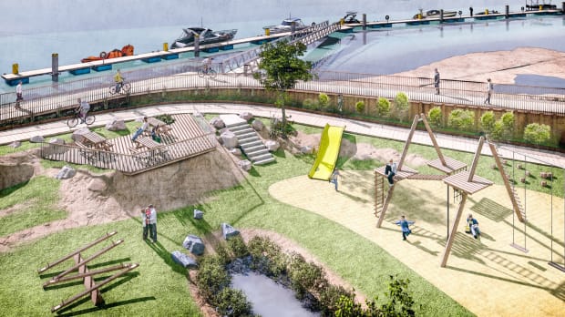
    Flood risk has been the key driver for a design solution that addresses planning, building forms, landscaping and place making and includes a variety of measures which together provide a holistic solution approach to resilience but which also add richness and character to the design.

  • In the aftermath of a disaster, the speed and effectiveness of the community in bouncing back provide an indication of the community resilience.

    • Safe Havens – there are four home zones, each a safe haven from flooding.
    • Land Raising – each home zone is raised to prevent flooding.
    • Safe access – the homes can be accessed safely even in the event of a flood.
    • Absorbent landscape – The whole development is set within a large floodable park.
    • Raised floor levels – there are no bedrooms or living spaces at the lowest level.
    • Elevated Buildings – the buildings are built on stilts above parking or utility spaces.
    • Resilient construction – the lower floor of the buildings is designed to resist flood water.
    • Sustainable drainage – permeable paving, swales and ponds throughout the landscape
    • Early Warning – the residents have access to an early warning system.
  • Climping to Littlehampton Climping to Littlehampton Climping to Littlehampton Climping to Littlehampton

    Climping to Littlehampton

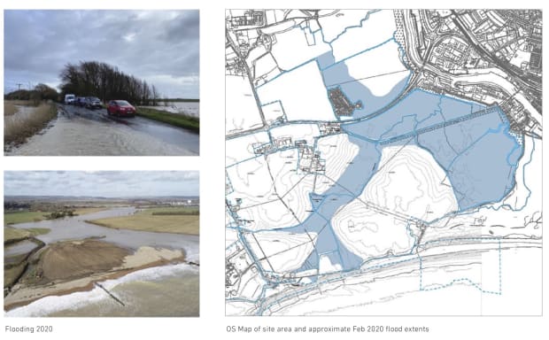
    In February 2020, Storm Ciara caused a breach in coastal defences resulted in extensive flooding between Littlehampton and Climping.  Ferry Road, a key access road, and large areas of farmland were inundated with sea water, with access to homes and businesses cut off for days on end. Although flooding stopped short of homes in Climping Park and Rope Walk, the damage caused to the community and infrastructure ran into thousands of pounds.

    We are currently working on a Local-community Coastal Adaptation Scheme (Lo-CAS) for a similar region on the south coast at such significant risk from both river and coastal flooding.

    Government funding stipulates that defences must be built to last 100 years, but without funding it is difficult to deliver defences that will last even 20 or 3 years, and so an alliance of landowners, local authority, environment agency and other stakeholders has been formed to find a workable solution.

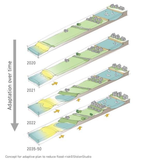
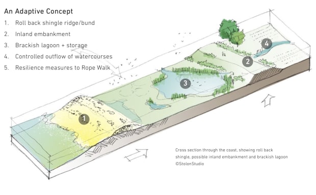
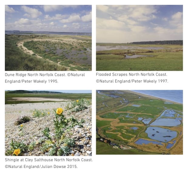
    Working closely with the alliance, our proposal enhances resilience by working with natural processes, making incremental improvements over time to achieve an adaptive coastal realignment, and biodiversity improvements.

  • publications